
龙城区 topographic map
Interactive map
Click on the map to display elevation.
About this map
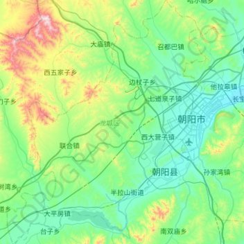
Name: 龙城区 topographic map, elevation, terrain.
Location: 龙城区, 朝阳市, 辽宁省, 中国 (41.38306 120.06214 41.75526 120.46933)
Average elevation: 349 m
Minimum elevation: 153 m
Maximum elevation: 1,133 m
Other topographic maps
Click on a map to view its topography, its elevation and its terrain.