
凌源市 topographic map
Interactive map
Click on the map to display elevation.
About this map
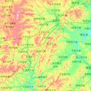
Name: 凌源市 topographic map, elevation, terrain.
Location: 凌源市, 朝阳市, 辽宁省, 122500, 中国 (40.59733 118.83988 41.42257 119.63092)
Average elevation: 575 m
Minimum elevation: 270 m
Maximum elevation: 1,308 m
Other topographic maps
Click on a map to view its topography, its elevation and its terrain.