
两林乡 topographic map
Interactive map
Click on the map to display elevation.
About this map
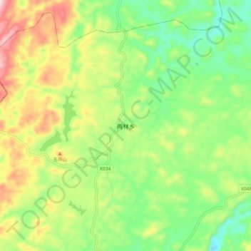
Name: 两林乡 topographic map, elevation, terrain.
Location: 两林乡, 凤凰县, 湘西土家族苗族自治州, 湖南省, 中国 (28.11779 109.34385 28.19779 109.42385)
Average elevation: 845 m
Minimum elevation: 691 m
Maximum elevation: 1,083 m
Other topographic maps
Click on a map to view its topography, its elevation and its terrain.