
杂谷脑镇 topographic map
Interactive map
Click on the map to display elevation.
About this map
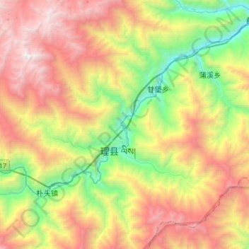
Name: 杂谷脑镇 topographic map, elevation, terrain.
Location: 杂谷脑镇, 理县, 阿坝藏族羌族自治州, 四川省, 中国 (31.36959 103.03266 31.55089 103.28984)
Average elevation: 3,140 m
Minimum elevation: 1,593 m
Maximum elevation: 5,071 m
Other topographic maps
Click on a map to view its topography, its elevation and its terrain.