
毕棚沟 topographic map
Interactive map
Click on the map to display elevation.
About this map
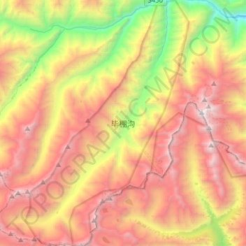
Name: 毕棚沟 topographic map, elevation, terrain.
Location: 毕棚沟, 朴头镇, 汶川卧龙特别行政区, 理县, 阿坝藏族羌族自治州, 四川省, 中国 (31.19901 102.83633 31.41399 103.00447)
Average elevation: 3,984 m
Minimum elevation: 2,058 m
Maximum elevation: 5,843 m
Other topographic maps
Click on a map to view its topography, its elevation and its terrain.