
德格县 topographic map
Interactive map
Click on the map to display elevation.
About this map
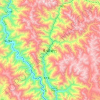
Name: 德格县 topographic map, elevation, terrain.
Location: 德格县, 甘孜藏族自治州, 四川省, 627200, 中国 (31.64890 98.42067 31.96890 98.74067)
Average elevation: 4,073 m
Minimum elevation: 3,030 m
Maximum elevation: 5,061 m
Other topographic maps
Click on a map to view its topography, its elevation and its terrain.