
曲登乡 topographic map
Interactive map
Click on the map to display elevation.
About this map
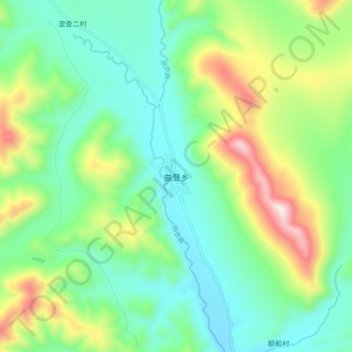
Name: 曲登乡 topographic map, elevation, terrain.
Location: 曲登乡, 理塘县, 甘孜藏族自治州, 四川省, 中国 (30.41102 99.78745 30.49102 99.86745)
Average elevation: 4,475 m
Minimum elevation: 4,254 m
Maximum elevation: 4,989 m
Other topographic maps
Click on a map to view its topography, its elevation and its terrain.