
热拉村 topographic map
Interactive map
Click on the map to display elevation.
About this map
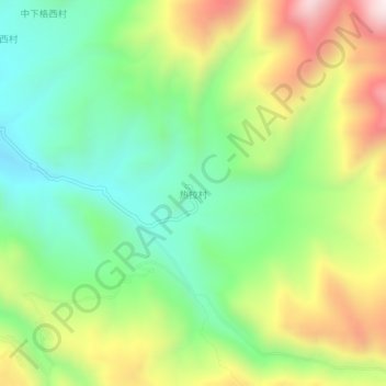
Name: 热拉村 topographic map, elevation, terrain.
Location: 热拉村, 木拉镇, 理塘县, 甘孜藏族自治州, 四川省, 中国 (29.54557 100.69788 29.58557 100.73788)
Average elevation: 3,941 m
Minimum elevation: 3,639 m
Maximum elevation: 4,421 m