
临澧县 topographic map
Interactive map
Click on the map to display elevation.
About this map
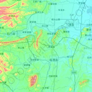
Name: 临澧县 topographic map, elevation, terrain.
Location: 临澧县, 常德市, 湖南省, 中国 (29.26094 111.42197 29.77008 111.83825)
Average elevation: 97 m
Minimum elevation: 28 m
Maximum elevation: 599 m
Other topographic maps
Click on a map to view its topography, its elevation and its terrain.