
凤仪镇 topographic map
Interactive map
Click on the map to display elevation.
About this map
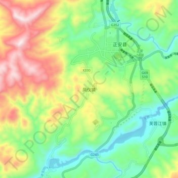
Name: 凤仪镇 topographic map, elevation, terrain.
Location: 凤仪镇, 遵义市, 贵州省, 中国 (28.49624 107.39384 28.57624 107.47384)
Average elevation: 772 m
Minimum elevation: 479 m
Maximum elevation: 1,262 m
Other topographic maps
Click on a map to view its topography, its elevation and its terrain.