
襄阳市 topographic map
Interactive map
Click on the map to display elevation.
About this map
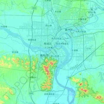
Name: 襄阳市 topographic map, elevation, terrain.
Location: 襄阳市, 襄城区, 襄阳市, 湖北省, 441021, 中国 (31.85992 111.98541 32.17992 112.30541)
Average elevation: 91 m
Minimum elevation: 52 m
Maximum elevation: 433 m
Other topographic maps
Click on a map to view its topography, its elevation and its terrain.