
蒋溪 topographic map
Interactive map
Click on the map to display elevation.
About this map
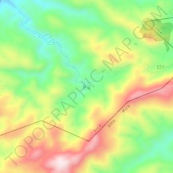
Name: 蒋溪 topographic map, elevation, terrain.
Location: 蒋溪, 天柱县, 黔东南苗族侗族自治州, 贵州省, 中国 (26.69574 109.34163 26.73574 109.38163)
Average elevation: 561 m
Minimum elevation: 349 m
Maximum elevation: 819 m
Other topographic maps
Click on a map to view its topography, its elevation and its terrain.