
燕子沟镇 topographic map
Interactive map
Click on the map to display elevation.
About this map
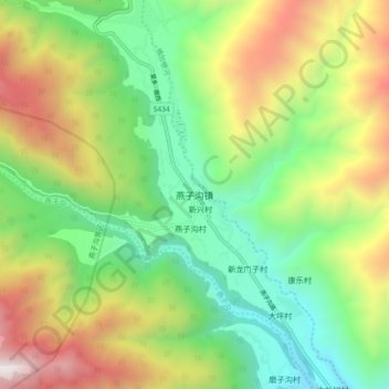
Name: 燕子沟镇 topographic map, elevation, terrain.
Location: 燕子沟镇, 泸定县, 甘孜藏族自治州, 四川省, 中国 (29.65424 102.04382 29.73424 102.12382)
Average elevation: 2,445 m
Minimum elevation: 1,561 m
Maximum elevation: 3,884 m
Other topographic maps
Click on a map to view its topography, its elevation and its terrain.