
滨海路街道 topographic map
Interactive map
Click on the map to display elevation.
About this map
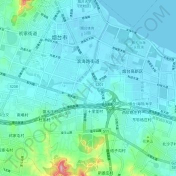
Name: 滨海路街道 topographic map, elevation, terrain.
Location: 滨海路街道, 莱山区, 烟台市, 山东省, 264000, 中国 (37.40795 121.43406 37.47612 121.48882)
Average elevation: 24 m
Minimum elevation: -2 m
Maximum elevation: 184 m
Other topographic maps
Click on a map to view its topography, its elevation and its terrain.