
院格庄街道 topographic map
Interactive map
Click on the map to display elevation.
About this map
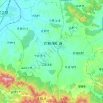
Name: 院格庄街道 topographic map, elevation, terrain.
Location: 院格庄街道, 莱山区, 烟台市, 山东省, 264000, 中国 (37.24718 121.31531 37.34769 121.42375)
Average elevation: 113 m
Minimum elevation: 15 m
Maximum elevation: 462 m
Other topographic maps
Click on a map to view its topography, its elevation and its terrain.