
黄海路街道 topographic map
Interactive map
Click on the map to display elevation.
About this map
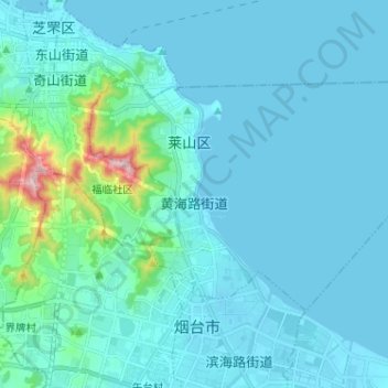
Name: 黄海路街道 topographic map, elevation, terrain.
Location: 黄海路街道, 莱山区, 烟台市, 山东省, 264000, 中国 (37.46567 121.40681 37.52715 121.53488)
Average elevation: 38 m
Minimum elevation: -1 m
Maximum elevation: 390 m