
莱芜区 topographic map
Interactive map
Click on the map to display elevation.
About this map
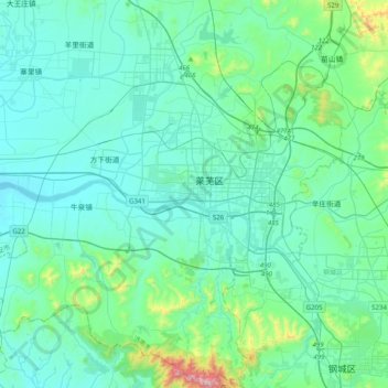
Name: 莱芜区 topographic map, elevation, terrain.
Location: 莱芜区, 山东省, 271100, 中国 (36.04308 117.49408 36.36308 117.81408)
Average elevation: 257 m
Minimum elevation: 147 m
Maximum elevation: 986 m
Other topographic maps
Click on a map to view its topography, its elevation and its terrain.