
泾源县 topographic map
Interactive map
Click on the map to display elevation.
About this map
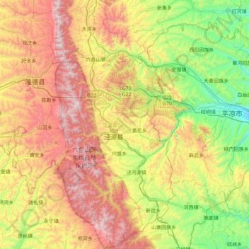
Name: 泾源县 topographic map, elevation, terrain.
Location: 泾源县, 固原市, 宁夏回族自治区, 中国 (35.23877 106.18288 35.79340 106.50469)
Average elevation: 1,970 m
Minimum elevation: 1,336 m
Maximum elevation: 2,913 m
Other topographic maps
Click on a map to view its topography, its elevation and its terrain.