
盐池县 topographic map
Interactive map
Click on the map to display elevation.
About this map
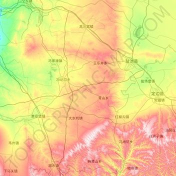
Name: 盐池县 topographic map, elevation, terrain.
Location: 盐池县, 吴忠市, 宁夏回族自治区, 中国 (37.08087 106.57850 38.16145 107.65254)
Average elevation: 1,459 m
Minimum elevation: 1,150 m
Maximum elevation: 1,940 m
Other topographic maps
Click on a map to view its topography, its elevation and its terrain.