
白土岗乡 topographic map
Interactive map
Click on the map to display elevation.
About this map
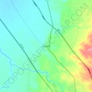
Name: 白土岗乡 topographic map, elevation, terrain.
Location: 白土岗乡, 宁夏回族自治区, 中国 (37.79056 106.29742 37.87056 106.37742)
Average elevation: 1,167 m
Minimum elevation: 1,138 m
Maximum elevation: 1,250 m
Other topographic maps
Click on a map to view its topography, its elevation and its terrain.