
尧化街道 topographic map
Interactive map
Click on the map to display elevation.
About this map
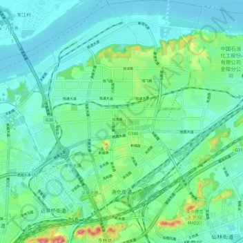
Name: 尧化街道 topographic map, elevation, terrain.
Location: 尧化街道, 栖霞区, 南京市, 江苏省, 210046, 中国 (32.09850 118.84834 32.18127 118.90840)
Average elevation: 24 m
Minimum elevation: 0 m
Maximum elevation: 114 m
Other topographic maps
Click on a map to view its topography, its elevation and its terrain.