
南河 topographic map
Interactive map
Click on the map to display elevation.
About this map
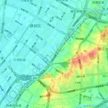
Name: 南河 topographic map, elevation, terrain.
Location: 南河, 南京市, 雨花台区, 江苏省, 210017, 中国 (31.95928 118.70655 32.02085 118.76057)
Average elevation: 18 m
Minimum elevation: 2 m
Maximum elevation: 67 m
Other topographic maps
Click on a map to view its topography, its elevation and its terrain.