
惠阳区 topographic map
Interactive map
Click on the map to display elevation.
About this map
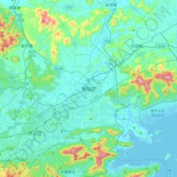
Name: 惠阳区 topographic map, elevation, terrain.
Location: 惠阳区, 惠州市, 广东省, 516211, 中国 (22.63200 114.29144 22.95200 114.61144)
Average elevation: 99 m
Minimum elevation: -3 m
Maximum elevation: 715 m
Other topographic maps
Click on a map to view its topography, its elevation and its terrain.