
江头镇 topographic map
Interactive map
Click on the map to display elevation.
About this map
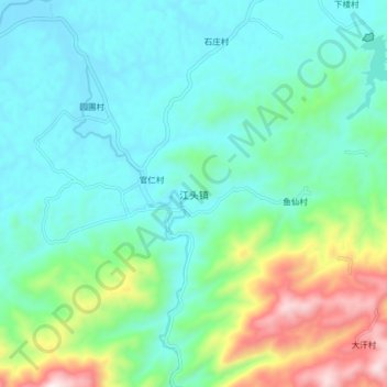
Name: 江头镇 topographic map, elevation, terrain.
Location: 江头镇, 南雄市, 韶关市, 广东省, 中国 (25.04649 114.40544 25.12649 114.48544)
Average elevation: 300 m
Minimum elevation: 124 m
Maximum elevation: 866 m
Other topographic maps
Click on a map to view its topography, its elevation and its terrain.