
奇山街道 topographic map
Interactive map
Click on the map to display elevation.
About this map
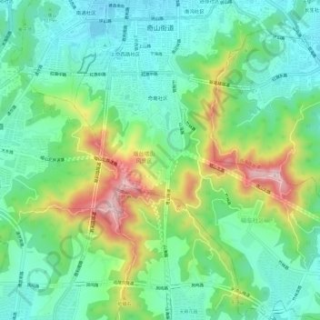
Name: 奇山街道 topographic map, elevation, terrain.
Location: 奇山街道, 芝罘区, 烟台市, 山东省, 264000, 中国 (37.48287 121.38098 37.53056 121.43689)
Average elevation: 133 m
Minimum elevation: 16 m
Maximum elevation: 390 m
Other topographic maps
Click on a map to view its topography, its elevation and its terrain.