
双泉镇 topographic map
Interactive map
Click on the map to display elevation.
About this map
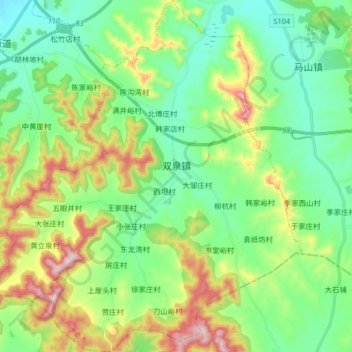
Name: 双泉镇 topographic map, elevation, terrain.
Location: 双泉镇, 长清区, 济南市, 山东省, 250300, 中国 (36.27583 116.62253 36.40705 116.77016)
Average elevation: 194 m
Minimum elevation: 50 m
Maximum elevation: 516 m
Other topographic maps
Click on a map to view its topography, its elevation and its terrain.