
大厂回族自治县 topographic map
Interactive map
Click on the map to display elevation.
About this map
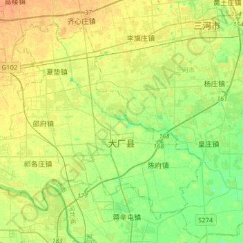
Name: 大厂回族自治县 topographic map, elevation, terrain.
Location: 大厂回族自治县, 廊坊市, 河北省, 中国 (39.82174 116.80626 39.98243 117.06538)
Average elevation: 20 m
Minimum elevation: 5 m
Maximum elevation: 32 m
Other topographic maps
Click on a map to view its topography, its elevation and its terrain.