
青片乡 topographic map
Interactive map
Click on the map to display elevation.
About this map
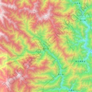
Name: 青片乡 topographic map, elevation, terrain.
Location: 青片乡, 北川羌族自治县, 绵阳市, 四川省, 中国 (31.90611 103.74621 32.16431 104.08067)
Average elevation: 2,256 m
Minimum elevation: 891 m
Maximum elevation: 3,955 m
Other topographic maps
Click on a map to view its topography, its elevation and its terrain.