
徒骇河 topographic map
Interactive map
Click on the map to display elevation.
About this map
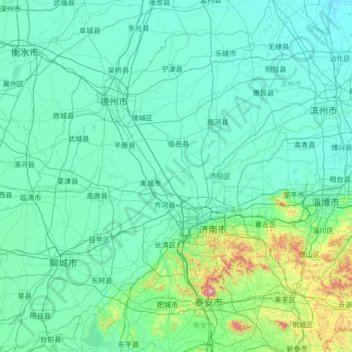
Name: 徒骇河 topographic map, elevation, terrain.
Location: 徒骇河, 德州市, 齐河县, 山东省, 251100, 中国 (35.92079 115.42689 38.00662 118.13465)
Average elevation: 79 m
Minimum elevation: -1 m
Maximum elevation: 1,472 m
Other topographic maps
Click on a map to view its topography, its elevation and its terrain.