
青原区 topographic map
Interactive map
Click on the map to display elevation.
About this map
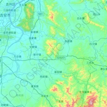
Name: 青原区 topographic map, elevation, terrain.
Location: 青原区, 吉安市, 江西省, 中国 (26.65354 114.98423 27.16315 115.50695)
Average elevation: 165 m
Minimum elevation: 36 m
Maximum elevation: 1,188 m
Other topographic maps
Click on a map to view its topography, its elevation and its terrain.