
富田镇 topographic map
Interactive map
Click on the map to display elevation.
About this map
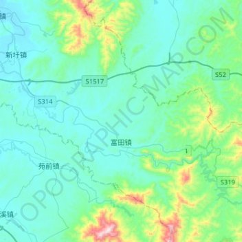
Name: 富田镇 topographic map, elevation, terrain.
Location: 富田镇, 青原区, 吉安市, 江西省, 中国 (26.74047 115.11966 26.94202 115.37642)
Average elevation: 182 m
Minimum elevation: 56 m
Maximum elevation: 872 m
Other topographic maps
Click on a map to view its topography, its elevation and its terrain.