
封开县 topographic map
Interactive map
Click on the map to display elevation.
About this map
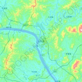
Name: 封开县 topographic map, elevation, terrain.
Location: 封开县, 肇庆市, 广东省, 中国 (23.26701 111.34722 23.58701 111.66722)
Average elevation: 127 m
Minimum elevation: -2 m
Maximum elevation: 824 m
封开最高点在东部与德庆县交界的七星岩顶,海拔1274米。而位于北部长安镇的谠山海拔1175米,是县里居民比较喜欢攀爬的山峰。
Other topographic maps
Click on a map to view its topography, its elevation and its terrain.