
仁和区 topographic map
Interactive map
Click on the map to display elevation.
About this map
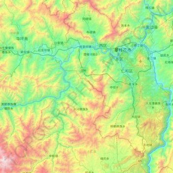
Name: 仁和区 topographic map, elevation, terrain.
Location: 仁和区, 攀枝花市, 四川省, 中国 (26.08637 101.39333 26.78518 101.93787)
Average elevation: 1,712 m
Minimum elevation: 891 m
Maximum elevation: 2,945 m
Other topographic maps
Click on a map to view its topography, its elevation and its terrain.