
密地街道 topographic map
Interactive map
Click on the map to display elevation.
About this map
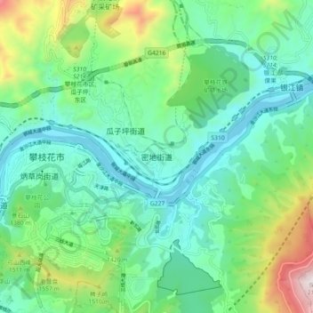
Name: 密地街道 topographic map, elevation, terrain.
Location: 密地街道, 攀枝花市, 四川省, 中国 (26.54592 101.70941 26.62592 101.78941)
Average elevation: 1,268 m
Minimum elevation: 974 m
Maximum elevation: 2,129 m