
睢阳区 topographic map
Interactive map
Click on the map to display elevation.
About this map
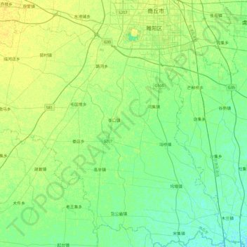
Name: 睢阳区 topographic map, elevation, terrain.
Location: 睢阳区, 商丘市, 河南省, 中国 (34.05838 115.32789 34.43202 115.78015)
Average elevation: 48 m
Minimum elevation: 41 m
Maximum elevation: 57 m
Other topographic maps
Click on a map to view its topography, its elevation and its terrain.