
Sherbrooke topographic map
Interactive map
Click on the map to display elevation.
About this map
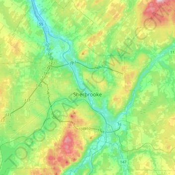
Name: Sherbrooke topographic map, elevation, terrain.
Location: Sherbrooke, Estrie, Quebec, Canada (45.29990 -72.10879 45.52405 -71.80254)
Average elevation: 232 m
Minimum elevation: 125 m
Maximum elevation: 476 m
Other topographic maps
Click on a map to view its topography, its elevation and its terrain.