
俄真 topographic map
Interactive map
Click on the map to display elevation.
About this map
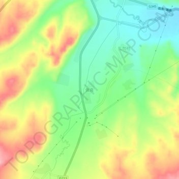
Name: 俄真 topographic map, elevation, terrain.
Location: 俄真, 红星镇, 若尔盖县, 阿坝藏族羌族自治州, 四川省, 中国 (34.05815 102.71244 34.09815 102.75244)
Average elevation: 3,223 m
Minimum elevation: 3,157 m
Maximum elevation: 3,305 m
Other topographic maps
Click on a map to view its topography, its elevation and its terrain.