
彭溪 topographic map
Interactive map
Click on the map to display elevation.
About this map
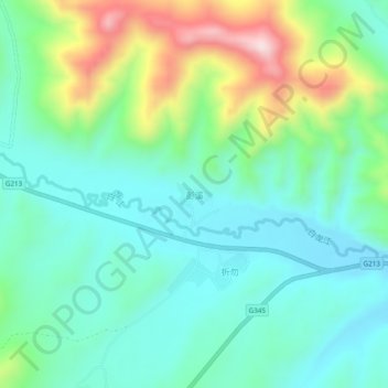
Name: 彭溪 topographic map, elevation, terrain.
Location: 彭溪, 红星镇, 若尔盖县, 阿坝藏族羌族自治州, 四川省, 中国 (34.09080 102.68400 34.13080 102.72400)
Average elevation: 3,314 m
Minimum elevation: 3,188 m
Maximum elevation: 3,646 m
Other topographic maps
Click on a map to view its topography, its elevation and its terrain.