
邱家镇 topographic map
Interactive map
Click on the map to display elevation.
About this map
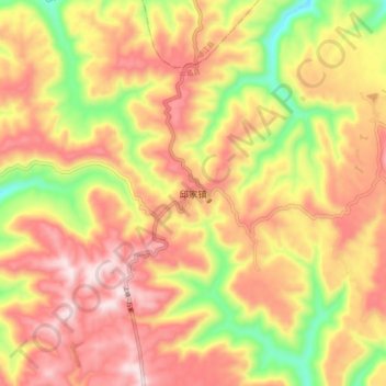
Name: 邱家镇 topographic map, elevation, terrain.
Location: 邱家镇, 平昌县, 巴中市, 四川省, 中国 (31.58907 107.28579 31.66907 107.36579)
Average elevation: 679 m
Minimum elevation: 397 m
Maximum elevation: 889 m
Other topographic maps
Click on a map to view its topography, its elevation and its terrain.