
武胜驿镇 topographic map
Interactive map
Click on the map to display elevation.
About this map
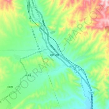
Name: 武胜驿镇 topographic map, elevation, terrain.
Location: 武胜驿镇, 永登县, 兰州市, 甘肃省, 中国 (36.84212 103.12911 36.92212 103.20911)
Average elevation: 2,422 m
Minimum elevation: 2,232 m
Maximum elevation: 2,838 m
Other topographic maps
Click on a map to view its topography, its elevation and its terrain.