
中堡镇 topographic map
Interactive map
Click on the map to display elevation.
About this map
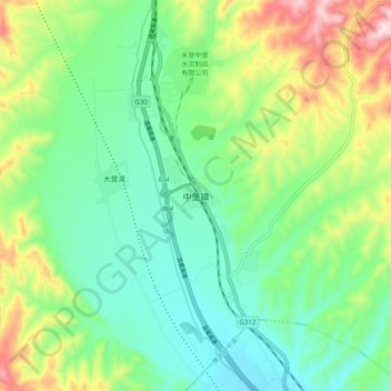
Name: 中堡镇 topographic map, elevation, terrain.
Location: 中堡镇, 永登县, 兰州市, 甘肃省, 中国 (36.76502 103.17414 36.84502 103.25414)
Average elevation: 2,272 m
Minimum elevation: 2,137 m
Maximum elevation: 2,567 m
Other topographic maps
Click on a map to view its topography, its elevation and its terrain.