
大坝场镇 topographic map
Interactive map
Click on the map to display elevation.
About this map
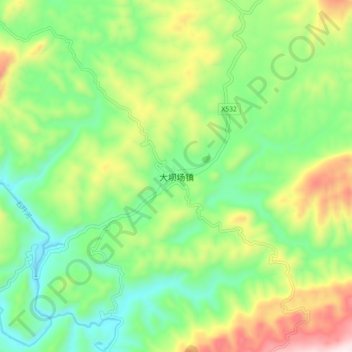
Name: 大坝场镇 topographic map, elevation, terrain.
Location: 大坝场镇, 思南县, 铜仁市, 贵州省, 558000, 中国 (27.69899 108.30154 27.77899 108.38154)
Average elevation: 648 m
Minimum elevation: 402 m
Maximum elevation: 1,104 m
Other topographic maps
Click on a map to view its topography, its elevation and its terrain.