
双塘街道 topographic map
Interactive map
Click on the map to display elevation.
About this map
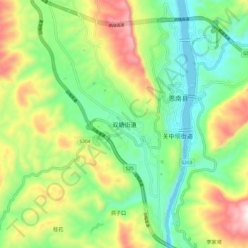
Name: 双塘街道 topographic map, elevation, terrain.
Location: 双塘街道, 思南县, 贵州省, 中国 (27.89585 108.19022 27.97585 108.27022)
Average elevation: 611 m
Minimum elevation: 350 m
Maximum elevation: 1,068 m
Other topographic maps
Click on a map to view its topography, its elevation and its terrain.