
大河坝镇 topographic map
Interactive map
Click on the map to display elevation.
About this map
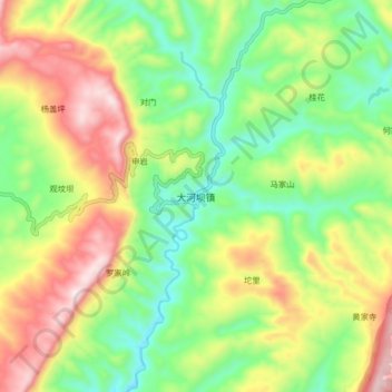
Name: 大河坝镇 topographic map, elevation, terrain.
Location: 大河坝镇, 思南县, 铜仁市, 贵州省, 558000, 中国 (27.84163 108.13803 27.92163 108.21803)
Average elevation: 722 m
Minimum elevation: 466 m
Maximum elevation: 1,091 m