
Ntcheu topographic map
Interactive map
Click on the map to display elevation.
About this map
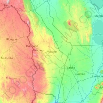
Name: Ntcheu topographic map, elevation, terrain.
Location: Ntcheu, Central Region, Malawi, Malawi (-15.32956 34.40000 -14.33079 34.97441)
Average elevation: 904 m
Minimum elevation: 437 m
Maximum elevation: 2,148 m
Other topographic maps
Click on a map to view its topography, its elevation and its terrain.
Lake Chilwa
Lake Chilwa, Zomba, Southern Region, Malawi
Average elevation: 647 m