
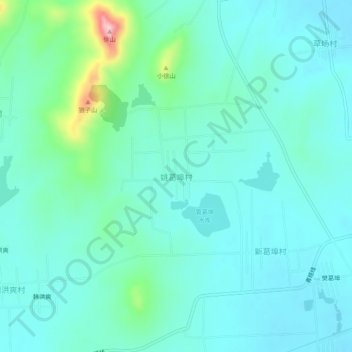
姚葛埠村 topographic map
Interactive map
Click on the map to display elevation.
About this map
Name: 姚葛埠村 topographic map, elevation, terrain.
Location: 姚葛埠村, 连云港市, 江苏省, 中国 (34.90647 118.88254 34.94647 118.92254)
Average elevation: 68 m
Minimum elevation: 29 m
Maximum elevation: 248 m
Other topographic maps
Click on a map to view its topography, its elevation and its terrain.