
下漆树沟 topographic map
Interactive map
Click on the map to display elevation.
About this map
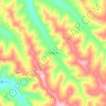
Name: 下漆树沟 topographic map, elevation, terrain.
Location: 下漆树沟, 陇西县, 定西市, 甘肃省, 中国 (34.92223 104.83488 34.96223 104.87488)
Average elevation: 1,988 m
Minimum elevation: 1,819 m
Maximum elevation: 2,135 m
Other topographic maps
Click on a map to view its topography, its elevation and its terrain.