
渭阳乡 topographic map
Interactive map
Click on the map to display elevation.
About this map
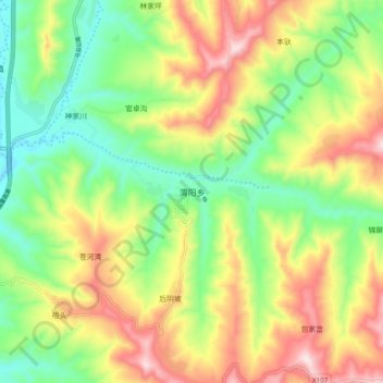
Name: 渭阳乡 topographic map, elevation, terrain.
Location: 渭阳乡, 陇西县, 定西市, 甘肃省, 中国 (35.04141 104.72867 35.12141 104.80867)
Average elevation: 1,911 m
Minimum elevation: 1,719 m
Maximum elevation: 2,172 m
Other topographic maps
Click on a map to view its topography, its elevation and its terrain.