
依兰县 topographic map
Interactive map
Click on the map to display elevation.
About this map
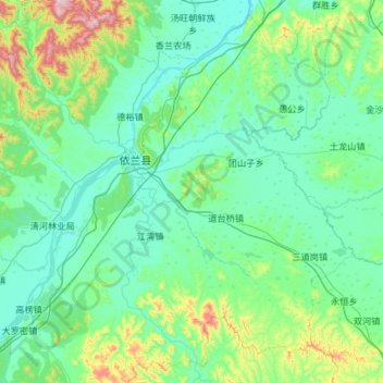
Name: 依兰县 topographic map, elevation, terrain.
Location: 依兰县, 哈尔滨市, 黑龙江省, 154800, 中国 (45.84365 129.19215 46.65628 130.23350)
Average elevation: 192 m
Minimum elevation: 81 m
Maximum elevation: 1,008 m
依兰县地层为前寒武系中元古界黑龙江群,属于黑龙江省东部地区新华夏系第二隆起带,此区域地质活动较为强烈,分为东西向和北东向,也是典型的盆地式半丘陵、半山区地带。依兰县四面环山,其中三面为张广才岭和完达山脉,北部则为小兴安岭余脉,四面围绕的山峰均为海拔150米以上。松花江、牡丹江、倭肯河、巴兰河这四条江河流经县境。
Other topographic maps
Click on a map to view its topography, its elevation and its terrain.