
香坊区 topographic map
Interactive map
Click on the map to display elevation.
About this map
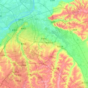
Name: 香坊区 topographic map, elevation, terrain.
Location: 香坊区, 哈尔滨市, 黑龙江省, 150000, 中国 (45.59290 126.55881 45.81689 126.99419)
Average elevation: 155 m
Minimum elevation: 112 m
Maximum elevation: 209 m
Other topographic maps
Click on a map to view its topography, its elevation and its terrain.